The most popular recreational ride in the country, the Camel Trail runs from Poley's Bridge and the wooded countryside of the upper Camel Valley down to Wadebridge and alongside the picturesque Camel Estuary as far as Padstow. The route is very busy in July and August.
The Route: Poley's Bridge - Bodmin - Wadebridge - Padstow.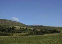
Distance: Poley's Bridge to Bodmin - 6 miles. Bodmin to Wadebridge - 5 miles. Wadebridge to Padstow - 5 miles, ie. up to 16 miles one way, 32 miles both.
Start & Parking: Several possible starting points and car parks - Poley's Bridge, Bodmin, Wadebridge and Padstow.
Surface & Hills: Stone / gravel path. Gentle (200 ft) climb from Wadebridge to Poley's Bridge.
Roads & Road Crossings: Take care crossing the busy A389 near to Bodmin. Short section on road through Wadebridge to rejoin the railway path.
Other nearby trails: the Camel Trail forms the start of Sustrans West Country Way which runs 250 miles from Padstow to Bristol. There is a waymarked forest trail in Cardinham Woods, NE of Bodmin.
Cycle Hire: Bridge Bike Hire, Tel: .
Map & Leaflet: OS Landranger Map 200. Leaflet available from Camel Trail Ranger, Cornwall Country Council, Camel Trail Office, Eddystone Road, Wadebridge, PL27 7AL. Tel: . There is also a new and useful little guidebook available from the Camel Trail and Wildlife Shop in Wadebridge. @Look at the Camel Trail', by Anita Dunstan, is a flora and fauna spotters guide. Tel: .
Nearest Railway: Bodmin Parkway Station, 6 miles southeast of the trail.
Refreshments: Lots of choice in Bodmin, Wadebridge and Padstow.