The following trails built on old railway lines first appeared in the publication "On Your Bike", Issue 5, Spring 1999 edition. Our thanks again go to Carlton Reid for allowing us to reproduce the information.
Rail Trail - Aidrie to Bathgate, east of Glasgow 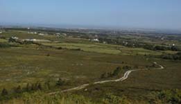
One of several long sections of dismantled railway paths in the Glasgow area (the others lie to the west of the city). The Airdrie to Bathgate path now forms part of Sustrans Clyde to Forth long distance trail.
The route: Airdrie - Caldercruix - Blackridge - (south of Armadale) - BathgateDistance: 15 miles one way, 30 miles bothStart & Parking.
1. Craigneuk, on the east of Airdrie, off the A89 Armadale road to the east of the roundabout with the A73.
2. Whiteside, southwest of Bathgate, just off the B7002.
Surface & Hills: Good quality gravel path. There is a gentle climb from Bathgate or Airdrie to Hillend Reservoir which is the highest point.
Road & Road Crossings: No major road crossings.
Links or other nearby trails: The new town of Livingston has a fine network of traffic-free cycleways. the Union Canal and Forth & clyde Canal lie to the north.
Map & Leaflet: OS Landranger Maps 64 and 65. Basic leaflet available from Sustrans, 53 Cochrane Street, Glasgow, G1 1HL Tel: .
Nearest Railway: Airdrie or Bathgate.Refreshments: Airdrie, Caldercruix, Blackridge and Bathgate.